
NISAR: A Revolutionary Earth Observation Satellite
Why in the News?
The NISAR (NASA-ISRO Synthetic Aperture Radar) satellite, a groundbreaking joint mission of NASA and ISRO, is scheduled for launch on July 30 from Sriharikota. This mission marks a historic collaboration in Earth observation and remote sensing, employing dual-frequency Synthetic Aperture Radar for climate monitoring, disaster response, and terrain analysis. The NISAR satellite, also known as the ISRO satellite in this collaborative effort, represents a significant leap forward in environmental protection and climate change mitigation efforts.
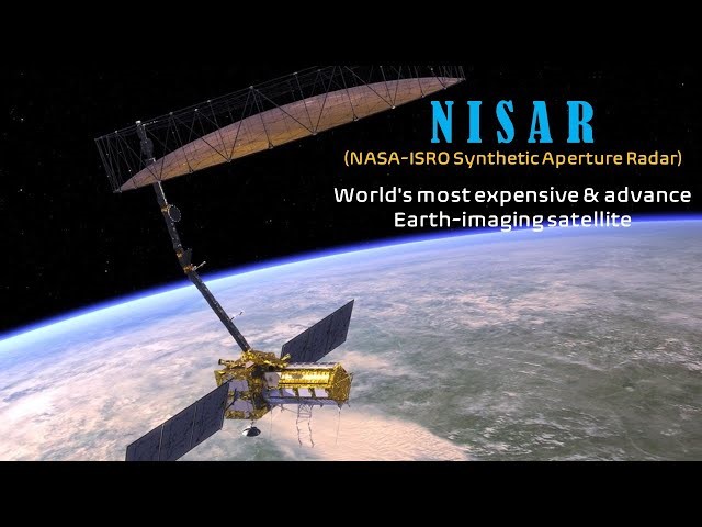
Key Launch and Mission Details:
● Launch Date: Scheduled for July 30 at 5:40 p.m. from Satish Dhawan Space Centre, Sriharikota.
● Launch Vehicle: To be placed in a 743-km sun-synchronous orbit via the GSLV-F16 rocket.
● Weight and Design: Weighs 2,392 kg, based on ISRO’s I3K satellite bus, with NASA’s 12m mesh reflector antenna.
● Frequency Innovation: World’s first satellite to use dual-frequency Synthetic Aperture Radar (L-band & S-band).
● Swathe and Frequency: Will cover a 242 km swathe and revisit every 12 days for consistent monitoring.
Applications and Strategic Uses
● Climate Monitoring: Tracks ground deformation, polar ice sheets, ice sheet movement, and vegetation dynamics with high spatial resolution. The NISAR satellite will play a crucial role in detecting potential ice-sheet collapse, contributing to climate change mitigation efforts.
● Disaster Response: Supports storm tracking, soil moisture mapping, and surface water monitoring, enhancing environmental protection measures.
● Security Uses: Enables ship detection, shoreline surveillance, maritime surveillance, and sea ice classification.
● Agriculture and Water: Vital for crop assessment, irrigation planning, and water resource management.
● Global Coverage: Offers all-weather, day-night global data using SweepSAR technology.
| About NISAR and International Cooperation: |
| ● Full Form: NISAR stands for NASA ISRO Synthetic Aperture Radar. |
| ● Collaboration History: Product of decade-long cooperation between ISRO and NASA’s Jet Propulsion Laboratory (JPL). NASA’s contribution includes components developed at the Wallops Flight Facility. |
| ● Technological Milestone: First major NASA-ISRO joint Earth science mission, showcasing international space cooperation. |
| ● Radar Technology: Utilizes L-band (NASA) for deeper penetration and S-band (ISRO) for surface-level detail. |
| ● Geopolitical Significance: Reflects strong Indo-US space diplomacy and advancing global Earth science infrastructure. |
The NISAR satellite’s advanced technology includes a solid-state recorder and a sophisticated payload data subsystem, ensuring efficient data collection and transmission for environmental monitoring and climate change mitigation efforts.