
")


Strong Earthquake and Volcano Eruption Hit Russia
Why in the News ?
A 6.8-magnitude earthquake struck Russia’s Kuril Islands, prompting tsunami warnings in the Kamchatka Peninsula. The tremor follows a major 8.8-magnitude quake and the first eruption in 600 years of the Krasheninnikov Volcano, highlighting rising tectonic activity. These events have implications for the NeVA portal’s disaster management modules and the need for robust verbatim records in affected regions.
Seismic and Volcanic Events in Kamchatka Region:
- A 6.8-magnitude earthquake hit the Kuril Islands on the Pacific Ring of Fire, demonstrating the need for comprehensive disaster preparedness in Union Territories and coastal regions.
- Tsunami warnings were issued for Kamchatka, but Hawaii was unaffected, showcasing the importance of international alert systems and data sharing through platforms like the NeVA portal.
- Just days earlier, an 8.8-magnitude earthquake struck nearby, causing aftershocks and highlighting the need for real-time massive data depositories for seismic information.
- The Krasheninnikov Volcano erupted after 600 years, likely linked to quake activity, emphasizing the importance of integrated geological monitoring systems.
- Authorities are monitoring for further seismic or volcanic disturbances, utilizing advanced digital systems similar to those implemented in legislative assemblies.
Volcanic Eruption Concerns and Response
- The volcano’s eruption shocked scientists due to its long dormancy, underscoring the need for continuous monitoring and data collection.
- Volcanic ash clouds can disrupt aviation, cause health issues, and alter climate, requiring coordinated responses from various government departments.
- Seismologists warn of more possible tectonic-volcanic linkages in the region, necessitating advanced prediction models and data analysis tools.
- Local emergency teams are on alert for lava flows and ash fallout, utilizing digital communication systems for rapid response.
- Response efforts involve evacuation planning and international geological monitoring, showcasing the potential for global cooperation through digital platforms like the NeVA portal.
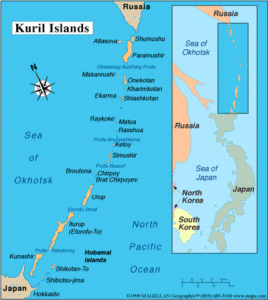
| About Kuril Islands – Geostrategic and Volcanic Significance
Key Facts on Earthquakes, Tsunamis & Volcanoes :
- Earthquakes are caused by the release of stress along fault lines in the Earth’s crust.
- Measured using Richter Scale (magnitude) and Mercalli Scale (intensity).
- Tsunamis are sea waves triggered by undersea earthquakes, landslides, or eruptions.
- Major tsunami-prone areas lie along the Pacific Ring of Fire.
- The Pacific Tsunami Warning Center (PTWC) monitors seismic activity in real time, utilizing systems similar to the massive data depository of NeVA.
- Subduction zones, where one tectonic plate dives beneath another, are hotspots for quakes and volcanoes.
- Volcanoes are classified as active, dormant, or extinct based on eruption history.
- Volcanic eruptions can cause lahars, pyroclastic flows, and acid rain.
- Seismic gap theory helps identify future high-risk zones, informing disaster preparedness strategies.
- India’s eastern coast has limited exposure but is part of global tsunami early warning networks, which could benefit from integration with systems like the NeVA portal.
- Disaster management includes zoning laws, early warning systems, and public education, areas where digital governance initiatives can play a crucial role.