
")


Typhoon Wipha Approaches South China, High Alert
Why in the News ?
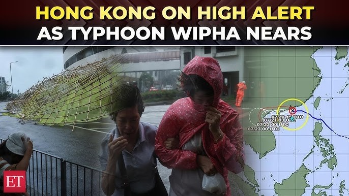
A high alert has been issued in South China’s Hainan and Guangdong provinces as Typhoon Wipha strengthens in the South China Sea. It is expected to bring heavy rains, strong winds, and make landfall soon, impacting coastal areas.
Current Status and Movement of Typhoon Wipha:
● Typhoon Wipha intensified from a tropical storm to a strong tropical storm early today.
● Its center is located about 930 km east of Wenchang City, Hainan, moving northwest at 20 km/h.
● It is rapidly gaining strength while approaching the coastlines of Shenzhen (Guangdong) and Wenchang (Hainan).
● Expected to make landfall between afternoon and night tomorrow.
● The storm brings the risk of heavy rainfall, gales, and sea disturbances in affected regions.
Impact on Coastal Regions and Preparedness
● From today till July 22, most sea areas and land parts of Hainan will face rainstorms and strong winds.
● The Hainan Meteorological Service has issued warnings to local authorities and residents for precautionary measures.
● Authorities are likely activating disaster management plans to mitigate damage and ensure public safety.
● Maritime activities and fishing operations in the South China Sea are expected to be disrupted.
● Residents are advised to stay indoors and follow official instructions closely.
| Understanding Typhoons and Their Impact: |
| ● Typhoons are intense tropical cyclones occurring in the Northwest Pacific Ocean and South China Sea. |
| ● They cause heavy rainfall, storm surges, and destructive winds leading to flooding and infrastructure damage. |
| ● Coastal areas are especially vulnerable to property damage, power outages, and transport disruption. |
| ● Early warnings and preparedness measures are critical to reduce human and economic losses. |
| ● China regularly monitors typhoons through meteorological agencies for timely alerts. |