
")


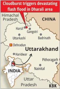
Flash Floods Devastate Dharali, Uttarkashi District
Why in the News ?
On August 5, flash floods and mudslides ravaged Dharali village in Uttarkashi, killing at least four. Triggered by extreme rainfall events, the disaster highlighted the region’s vulnerable topography, with rescue operations involving SDRF, NDRF, Army, and other forces.
Flash Flood Tragedy and Rescue Response:
- Around 1:50 PM, a sudden flash flood hit Dharali in Harsil Valley and the Bhagirathi river valley, sweeping away homes, shops, and infrastructure.
- Eyewitnesses described the scene as terrifying, comparing it to the 2013 Kedarnath tragedy.
- At least four people died, dozens were missing, and 60–70 were rescued by joint teams.
- Forces involved include SDRF, NDRF, Army, ITBP, and local police, supported by aerial rescue plans using MI and Chinook helicopters. The rescue efforts also focused on implementing flash flood management strategies.
- Roads remain blocked due to debris, while BRO and PWD are engaged in reopening access routes. Authorities are working on establishing early warning systems to prevent future casualties.
Geographical and Climatic Vulnerability
- Uttarkashi’s rugged topography, ranging from 800 to 6,900 metres, features steep slopes, valleys, and glacial deposits. The region’s vulnerability to glacial lake outburst floods is a growing concern.
- Continuous rain over fragile terrain leads to mudslides and debris flows that gain momentum rapidly. River training methods are being considered to mitigate future flood risks.
- The Kheer Ganga river overflowed due to sustained rainfall, not classified as a cloudburst (per IMD criteria).
- Climate change is accelerating glacial melt and rainfall intensity, worsening flood risk.
- Annual rainfall in Uttarkashi averages 1,289 mm, peaking in the southwest monsoon season, with an increasing frequency of extreme rainfall events.
What is a cloudburst ? |
| ● A cloudburst, per IMD, is defined as 100 mm+ rainfall in one hour over a 10×10 km area. |
| ● Flash floods are sudden surges caused by intense rainfall, glacial melt, or topographic instability. |
| ● 2013 Kedarnath floods are a key case study on Himalayan disaster vulnerability. |
| ● Institutions like SDRF, NDRF, and UCADA play a critical role in disaster preparedness and response. |
| ● The region lies near the Gangotri and Yamunotri glaciers, making it sensitive to both hydrological and seismic activity. |
In light of this disaster, authorities are emphasizing the need for improved disaster risk reduction and disaster risk management strategies. Local disaster management committees are being strengthened to enhance community preparedness and response capabilities.